We left on Saturday morning from Nashville. My dad, sister, her fiancé Miles, and I flew to Denver where we got our rental car, a Chevy Tahoe. Quite a bit better vehicle then our Dodge Nitro last time. We had some time to kill in Denver, so we (of course) visited REI, and a restaurant called "My Brother's Bar". Decent food, great beer. We then took a brewery tour at Breckenridge Brewery. It was a great craft beer experience with lots to choose from. We continued on our way to Buena Vista, Colorado which sits at the base of the Collegiate Peaks Wilderness.

We stayed at a small motel room, ate Mexican that night, and turned in for the night. We wanted to take it slow before we started approaching high altitudes, so staying in BV that night was probably smart.
The next morning we hung out in town, walked downtown, and watched the kayakers surf the waves on the Arkansas River. It is always fun returning to that river because I guided rafts on it all summer in 2008.
 Around midday we drove to the trailhead of Missouri Gulch, a large, beautiful valley surrounded my 14ers, all of which we were planning to climb. The trail up was steep with many switchbacks. After a mile or so of hiking, a storm rolled in a began dumping hail violently. It was an unexpected storm, as they usually are, so we scrambled to gather our rain gear. The hail pelted our exposed hands and stung, but it did not last long. After the storm passed, the ground glistened white with hail. Shortly after, we came upon the remains of an old miners cabin. This would be our campsite for the next two nights. The drizzling rain stopped, and we set up camp.
 The next morning, Tuesday, we rose about an hour before the sun and started up our first 14er, Mt. Belford. The approach through the valley was beautiful in twilight, but the trail quickly started straight up the northwest shoulder of Belford. The grassy switchbacks gave way to a rocky trail to the summit. The ascent took a few hours, but we made good time. The summit was a small rock pile topping out at 14,197 feet.
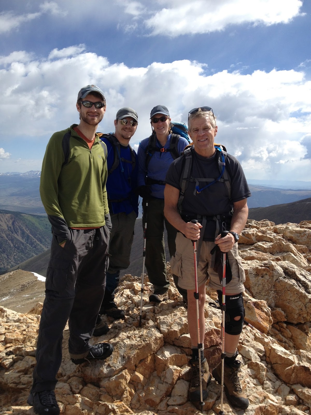
Having another peak to conquer the same day, we started for Mt. Oxford, about 1.5 miles away. Miles' altitude sickness started to get more severe, so he stayed back to recuperate. The descent down the saddle to the east between Belford and Oxford was steep and tedious. A trail runner who had passed up going up Belford was now passing us going back after having summited Belford and Oxford. Quite an athlete. My sister, dad, and I made good time traversing the saddle and back up Oxford.

Since Miles was still feeling nauseous, he and my sister stayed back the next day while my dad and I went for the summit of Missouri Mountain. The inconspicuous peak was to the west of Belford and was comprised of mostly a ridge line to the summit. My dad and I rose extra early (3:30am) to be on the trial before 4:30am. We hiked with our headlamps on for the first half hour or so. The air was cold and many of the stream crossings were frozen. Marmots scampered away as we hiked through the Alps-like valley toward Missouri Mountain. The snowy ridge dominated our view to the south as the sun began to rise to our east.

The ascent was exhausting, but we keep to it. After a few hours, we finally made it up to the ridge the occupied Missouri's northern ridge. Now, it was just another half mile of ridge walking. Much to our surprise, the snow and the steep angle made for a dangerous hike to the summit at 14,067 ft. We summited by 9:30 and had a fantastic view of the two peaks we had just climbed the day before.

Even better, we could see just about every fourteener within a 50 mile range. Mt. Harvard and Mt. Columbia to our southeast, Mt. Huron to our west, and far beyond, the famous Maroon Bells near Aspen. The Collegiate Range spread out further south and Mt. Elbert and La Plata Peak dominated to the view to the north. It was breathtaking, and we found ourselves not wanting to leave.
After an hour, we began our descent down to the green valley below. The hike down was somewhat straining, but the ability to talk to each other made the foot pounding more bearable. With the sun high in the sky, the temperature rose dramatically. He hiked in shorts and T-shirt back to camp where Miles and Mary Chris had been waiting for us. We made it down to camp by 2:30pm. We gathered the rest of our overnight gear and began hiking back down. The way down seems longer than the hike up 2 days before, probably because I was tired.
After reaching the car, we drove to Leadville for a dinner of pizza and Avalanche beer accompanied. Our hotel was quaint and relaxing. I got to talk to Julie a while which was great. The next day, we check out of our hotel and found a great little coffee shop in downtown Leadville, City on a Hill Coffee. We sat, ate breakfast, and talked for a while. It was one of my dad's favorites. With that day being our day off, we decided to drive to Aspen. The drive itself makes it worth it, over Independence Pass.

We arrived in Aspen around mid morning, so we passed the time by walking around the shops. This town has some really amazing flowers too. They were everywhere. Since being there last, the town had a more uppity feel to it. Maybe I just noticed it more.

We started up the trail early the next morning. It was unlike any other 14er trailhead I had experienced before since the start was practially above treeline. However, the approach through the valley was still long. After a couple hours of hiking, a trail runner passed us running up the trail. We watched him ahead of us the whole way. Since these two peaks are fairly close to Denver and easily accessible, the trail began gathering people behind us. We could see other groups start up the trail far below us, many of them with dogs. Our first peaks was Mt. Grays, a featureless rounded peak at 14,270 ft. We continued up the switchbacks until we finally made it to the summit. James, the only other camper at the campsite with us the previous night was on top with his dog Gemma. We chatted with him for a while, took in the views, and visited the mountain goats. As other climbers began reaching the summit, we started down for the saddle to Mt. Torreys. The hike down to the saddle was steep, but not as bad as coming down from Mt. Belford three days before. I got a second wind and pushed it up the summit of Mt. Torreys, a much sharper peak with little room for more than 10 people to occupy. With a height of 14,167 ft, we could see for miles. Mount of the Holy Cross stood to our west with its snowy cross unmelted. Just like Mt. Grays, the peak got congested with hikers, dogs, and gear, so we decided to make the trek down.
To be continued...